One platform to turn
nature & climate risks into action.
Map it. Quantify it. Act on it.
TEST OUR TOOL
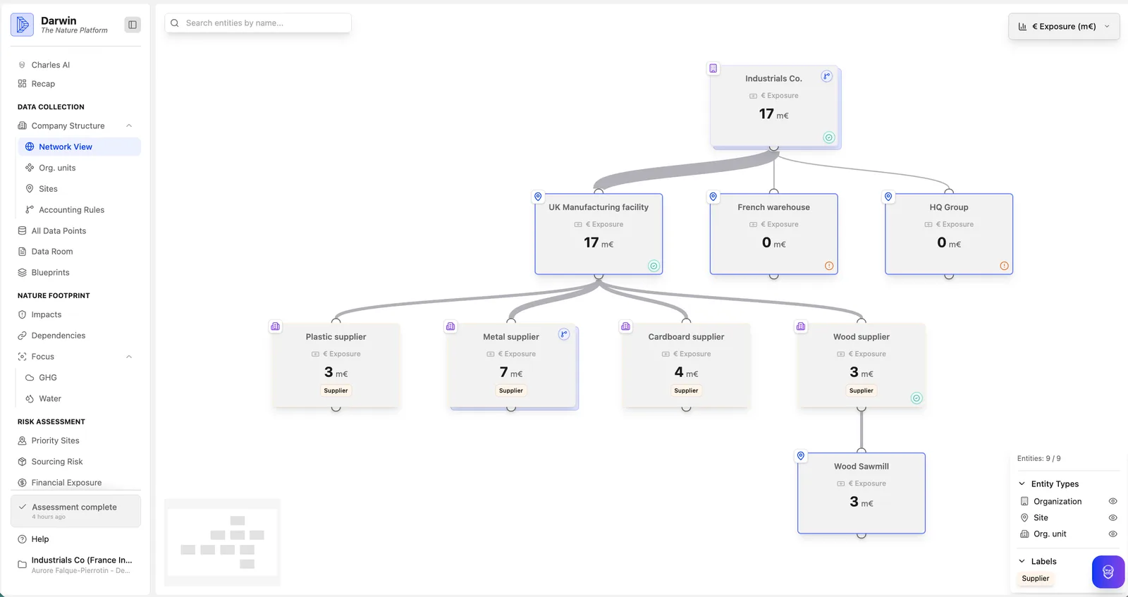
Map your organisation & collect data
Start by defining what matters for your business. Identify your operations — by business unit, site, or product line — and map where your supply chain connects to nature. Darwin helps you gather and organise the data you need, with automatic mappings or custom configurations built around your business model.
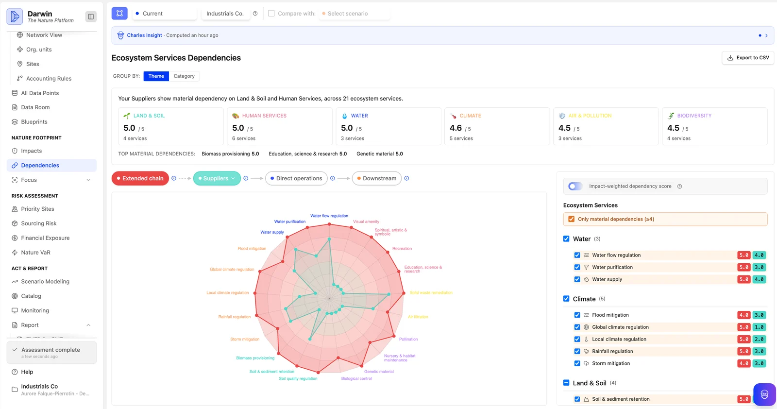
Assess your footprint
Understand exactly where and how your business affects nature. See which ecosystems your operations depend on, and drill into specific pressures — like water use, land occupation, or plastic pollution — so you know where to focus first.
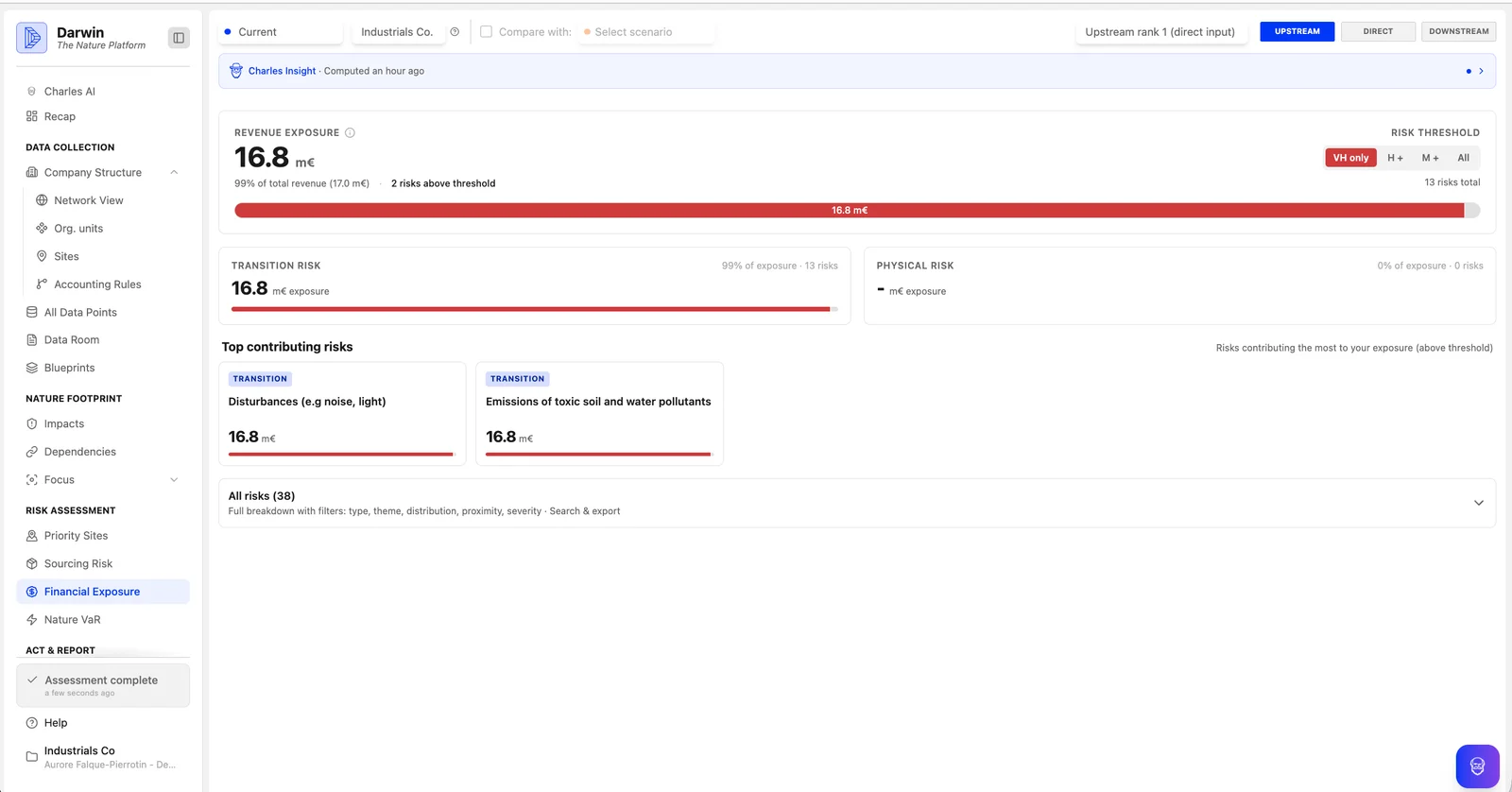
Quantify and manage your nature and climate risk — physical and transition
Put a number on your nature and climate risk, physical and transition together. Find out which sites, raw materials and suppliers are most exposed — today and in the future. Darwin calculates your potential losses up to 2050, so you know exactly what’s at stake. Climate hazards, ecosystem-service degradation and transition pressures are modelled per site as one exposure, so losses are never counted twice.
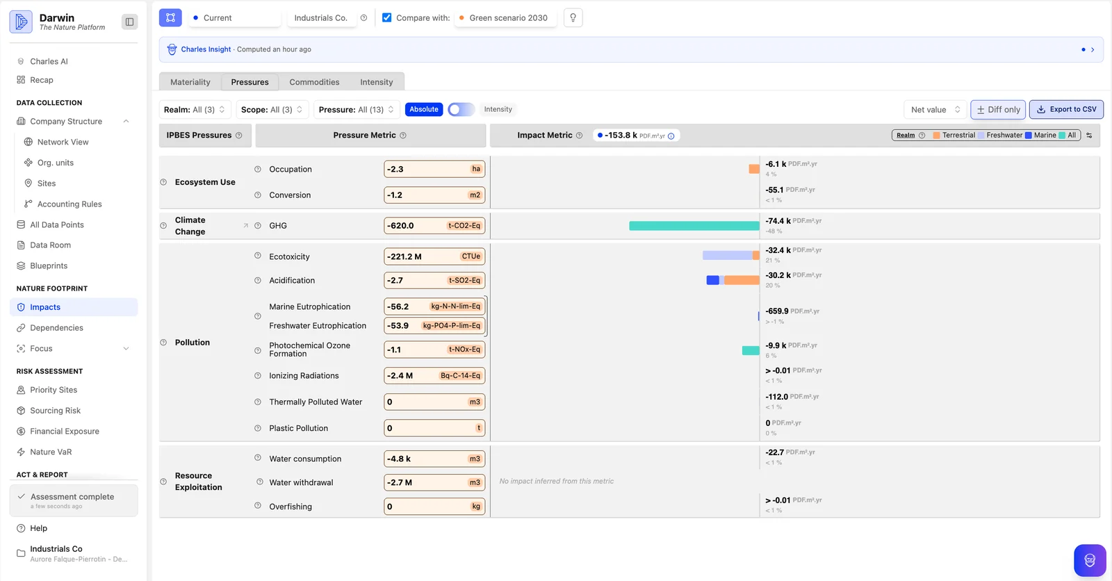
Act on your strategy
Turn data into action. Build mitigation plans, model alternative scenarios and identify your strongest resilience levers — and test how each site holds up under 2 SSP scenarios at 2035, 2050 and 2080. You can then make strategic decisions that tangibly improve your business resilience.
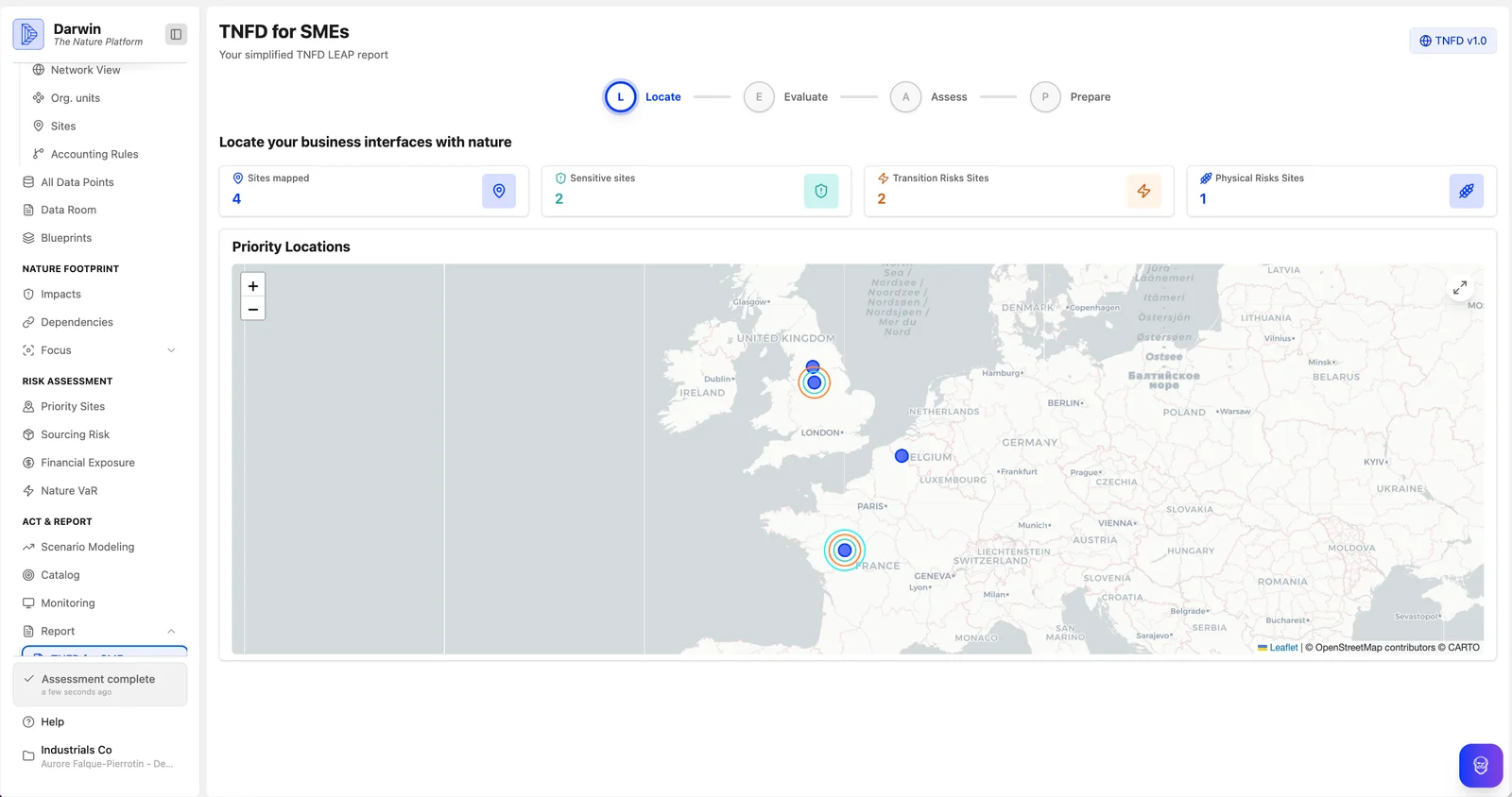
Report & share
Make reporting effortless. Track your key metrics in real time and export ready-to-use reports aligned with SFDR (incl. PAI), EU Taxonomy, CSRD, Article 29 LEC, TNFD, TCFD / IFRS S2 and SBTN, so you spend less time formatting and more time acting. Custom portfolio and company reports, and framework data packs, export directly from the platform.
What we model
Every driver is translated into an expected annual loss in euros, under 2 SSP scenarios, at 2035, 2050 and 2080 — for your own operations and for your value chain.
Built for strategic decisions, not just compliance.
360° modular solution
We cover every step of the nature strategy journey, from footprinting and risk analysis to reporting. Our modules are interoperable and flexible, allowing organizations to use only what they need and to scale over time as their ambitions evolve.
Action-first by design
Everything in Darwin is built around one question: what can you actually do about it? The platform uses concrete, measurable indicators (like water volume, land area, or tonnes of material) that map directly to real-world actions. Model scenarios and test reduction levers in just a few clicks.
AI-powered, built to scale
An engine that processes over 200 million data points in real time sits behind the platform. An AI co-pilot helps you ingest & clean data, interpret results, and draft reports; so you can move faster, even as your scope and ambitions grow.
Seamless, multi-level insight
Users can easily move between fund-, corporate-, product-, and asset-level views. The platform integrates upstream and downstream value-chain exposure beyond Scope 1 and incorporates spatial analysis to identify and locate high-risk sites.
Built for data gaps
We work with the data you already have — financial reports, carbon reports, LCA analyses, and more. No blank-sheet data collection is required. We model the gaps you can’t measure.
No black box effect
All assumptions, from pressure drivers to commodity mappings, are made explicit and fully traceable. Outputs are traceable and auditable, enabling users to understand, challenge, and act on their data with confidence.
Backed by Data & Science.
We use consensus-based third-party data. Our software is built on the latest scientific guidelines. And we follow the latest reporting standards, validated by the scientific community.